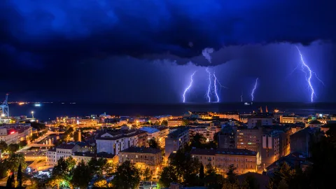
A winter thunderstorm is so rare that medieval chroniclers thought it worth recording. In 1396, Moscow saw thunder on December 25 — "there was thunder, and the cloud came from the south." Six centuries later, the physics of thunderstorms are well understood, but spotting lightning in the middle of a blizzard remains an extraordinary event.
Thunderstorms are always about energy. For lightning to flash across the sky, the atmosphere needs heat, moisture, and a sharp vertical temperature gradient. In summer, all three ingredients align almost daily. In winter — almost never. But "almost" is the key word here.
Why Thunderstorms Belong to Summer
A thunderstorm requires three conditions: heat, moisture, and atmospheric instability. In summer, all three coincide on a near-daily basis.
The sun heats the ground, and the ground heats the lowest layer of air. Warm air is lighter than cold air, so it starts rising. As it climbs, it cools, moisture condenses into droplets, and a cumulonimbus cloud forms — that dark tower you can watch growing upward in real time.
Inside the cloud, water droplets and ice crystals collide, separating electrical charges. The top of the cloud becomes positively charged, the bottom negatively charged. When the potential difference hits a critical threshold, a discharge occurs: lightning.
In summer, this process kicks off easily. The hotter the day, the stronger the updrafts, the taller and more powerful the cloud, and the more vigorous the charge separation. Peak thunderstorm activity in the mid-latitudes falls in the afternoon hours — when surface heating is at its maximum.
Why Winter Shuts the Whole Mechanism Down
In winter, the mechanism breaks at the very first step. The sun sits low, the surface doesn't heat up, updrafts are weak. Without powerful convection, the cloud can't grow to the necessary height, particle collisions inside it are too few, charge doesn't accumulate — and no discharge occurs.
On top of that, winter air is cold and dry — it holds very little moisture. Without moisture there's no condensation, no energy, no storm cloud. The entire chain that fires up in a couple of hours during summer simply never starts in winter.
When Winter Lightning Strikes Anyway
Rarely — but it happens. In English-language meteorology, the phenomenon has its own name: thundersnow.
Russian meteorologists don't have a dedicated term: forecasters simply log a thunderstorm and heavy snow as two simultaneous events.
The average recurrence of a winter thunderstorm for any given city is once every 5–10 years. But on a national scale, they occur practically every winter:
Moscow has recorded thundersnow in 1995, 2006, 2011, 2015, and 2019. Murmansk saw it in 2013, 2015, and 2016. In December 2015, Novosibirsk experienced its first-ever recorded winter thunderstorm. In December 2021, lightning struck a residential building in Sevastopol during a snowfall.
What Triggers a Thunderstorm in Winter
The primary driver of winter thunderstorms is the contrast between warm water and cold air. When an Arctic air mass passes over an unfrozen sea or a large lake, the lowest layer of air heats up and absorbs moisture almost instantly. It becomes unstable, surges upward, and cumulus clouds billow over the water like steam over a boiling pot.
Meteorologists have established a working rule: for vigorous winter convection, air at roughly 1.5 kilometers' altitude must be about 13°C colder than the water surface.
That's exactly why winter thunderstorms are most frequently recorded over the Black Sea and the Barents Sea, along the shores of the Great Lakes in America, and over the Sea of Japan.
The second scenario involves a violent collision of air masses along an atmospheric front. When warm, moist air from the south slams into cold Arctic air, vertical instability can be strong enough to spawn a storm cloud. These situations occur during the passage of powerful cyclones — and they're what produces lightning in the middle of blizzards.
Why Winter Thunderstorms Are Easy to Miss
Even when a winter thunderstorm does occur, it's much harder to notice than a summer one. There are fewer lightning bolts, and they're shorter and weaker. Thunder sounds muffled — snow absorbs sound waves, and rumbles are only audible within a few kilometers of the strike. In a city, that dampened thunder is easily lost beneath the noise of traffic and snowplows.
Research in recent years has shown that winter thunderstorms happen more often than previously believed — they simply went undetected. Satellites and modern lightning sensors can now "see" storms that no ground-level observer would have noticed.
Folk Wisdom vs. Science
An old folk saying holds that winter thunder foretells severe frost. There's a grain of truth in it. A winter thunderstorm signals sharp atmospheric instability, which often precedes an Arctic air invasion. After the clash of air masses that produced the storm, the cold front prevails — and temperatures plummet.
There's another pattern worth noting: a 2006 study found that in 86% of cases involving winter thunderstorms, snowfall exceeded 15 centimeters. Lightning in the middle of a blizzard is nearly a guarantee of heavy snow.
Will Winter Thunderstorms Become More Common?
Global warming is making the atmosphere more unstable. Warm water stays unfrozen longer, temperature contrasts sharpen, and the air holds more moisture.
In February 2026, a thundersnow event accompanied a historic snowfall on the U.S. East Coast — footage of lightning over snow-buried Buffalo went viral.
Scientists can't yet say definitively whether winter thunderstorms will become routine. But the trend over recent decades points toward increasing frequency and expanding geography. What once seemed an anomaly worthy of a medieval chronicle is gradually becoming part of winter's new normal.