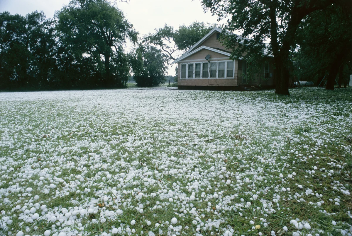
It's July, the thermometer reads +32°C, and suddenly ice balls start falling from the sky, covering lawns in a white layer within minutes. In May 2026, residents across six Russian regions — from Kuban to Novosibirsk — got exactly this kind of "icy greeting."
It looks like a glitch in nature's program: where does ice come from in thirty-degree heat? But the paradox is only skin-deep. In reality, hail is produced by heat itself.
The stronger the surface heating, the more powerful the updrafts, the taller the storm cloud grows — and the greater the chance that what falls isn't rain, but ice. A hailstone's story is a journey a water droplet takes from scorching asphalt to the top of a cloud at –40°C, and back down. Sometimes more than once.
How a Thunderstorm Cloud Is Born
It all begins at the surface. The sun heats the ground, the asphalt, the water. Warm, moist air becomes lighter than the surrounding air and starts rising — that's convection, the same principle by which steam rises off a boiling pot.
The hotter the day and the more moisture in the air, the more powerful the updraft.
At altitude, the air cools and water vapor condenses into droplets — a cloud forms. If convection is weak, the cloud stays flat and harmless — an ordinary cumulus, resembling a wisp of cotton. But if there's abundant energy, the cloud starts building upward like a tower: 10, 12, 15 km — all the way to the tropopause, the boundary between the troposphere and stratosphere.
At that altitude, temperature runs –50 to –60°C. The cloud's top hits the atmosphere's "ceiling" and spreads sideways, forming the signature anvil — a flat cap visible from dozens of kilometers away. This is the cumulonimbus cloud — a factory for thunderstorms, downpours, and hail.
What Happens Inside: An Elevator for Ice
Inside a cumulonimbus cloud is chaos: powerful updrafts reaching 30–40 m/s (over 100 km/h) and downdrafts carrying precipitation and cold air downward. It's this vertical "washing machine" that produces hail.
Stage 1: The Seed
A water droplet rises on an updraft to altitude where temperature drops below –10 to –15°C. There it collides with microscopic particles — dust, sand, bacteria — that serve as crystallization nuclei. The droplet freezes, becoming an ice grain under a millimeter across. This is the future hailstone's seed.
Stage 2: Growth
The grain grows heavier and begins to fall. But the updraft catches it and hurls it back upward — into a zone of supercooled droplets. Supercooled droplets remain liquid at subzero temperatures (down to –40°C!) due to the absence of impurities. On contact with the ice grain, they freeze instantly on its surface. The hailstone gains a new layer of ice.
Stage 3: The Elevator, Up and Down
The hailstone gets tossed upward again, gains another layer of ice, falls again, and rises again. Each cycle adds one layer. Cut a large hailstone in half, and you'll see concentric rings — clear and cloudy, like a tree's growth rings. Each ring represents one journey through the cloud.
Stage 4: The Fall
Once the hailstone grows so heavy that the updraft can no longer hold it, it drops out of the cloud and falls to the ground. Fall speed ranges from 20 to 50 m/s (up to 180 km/h for the largest specimens).
As the hailstone flies through warm air, its outer layer starts to melt — which is exactly why small hail arrives as rain, while large hail doesn't: it simply doesn't have time to melt on the way down.
Why This Happens Specifically in Summer
In winter, convection is essentially absent. The ground is covered in snow, which reflects sunlight, and surface air is cold and dense — with nowhere to rise. No updrafts means no cumulonimbus clouds means no hail.
Summer offers the opposite picture. The sun heats the surface to +30–40°C, moist air surges upward, and clouds grow to 10–15 km. The hotter the day, the more powerful the convection, and the larger the hailstone can grow.
That's why the most severe hail falls not during the shoulder seasons but at the height of summer — June, July, August — when the contrast between the scorching surface and the icy cloud top is at its maximum.
Time of day matters too. Hail most often falls in the afternoon, between 2 and 7 p.m., when the ground has heated to its peak and convection is strongest. Morning hail is rare.
How Big Do Hailstones Get?
The range runs from pea to grapefruit. Meteorologists classify it as follows:
- Small (under 1 cm) — harmless, melts within seconds of hitting the ground. Can go unnoticed.
- Medium (1–3 cm) — cherry- or walnut-sized. Already damages plant leaves and hits roofs.
- Large (3–5 cm) — quail- or chicken-egg-sized. Dents cars, punctures greenhouse film, dangerous for people caught outdoors.
- Giant (over 5 cm) — plum-, apple-sized, or bigger. Shatters windshields, tears off roof tiles, injures and kills.
In May 2026, chicken-egg-sized hail fell over Kuban: in the Kurganinsky district, dozens of cars were damaged, and in Belorechensky district, farmers lost their berry crops — strawberries shredded to nothing. In July of the same year, Krasnodar Krai was hit again — plum-sized hailstones punched through greenhouse coverings.
The world record belongs to a hailstone that fell in Vivian, South Dakota (USA) in 2010: diameter 20.3 cm, weight 878 grams — slightly bigger than a man's fist. Forming a hailstone of that size required an updraft exceeding 160 km/h.
Why Small Hail Melts and Large Hail Doesn't
The most common question: if it's +30°C outside, why doesn't the ice melt on the way down?
The answer lies in heat exchange physics. A small hailstone (3–5 mm) has a large surface area relative to its mass — it heats up fast and melts within seconds. It reaches the ground as a raindrop.
A large hailstone (3 cm or bigger) is massive, and warm air simply can't heat it through during the 30–60 seconds it takes to fall from cloud to ground. The outer layer partially melts, but the core stays frozen. The larger and heavier the hailstone, the faster it falls, the less time it has to melt, and the more ice survives to hit the ground.
That's exactly why the asphalt turns white after a severe hailstorm — as if snow had fallen. Ice sitting on the ground at +30°C can take 15–20 minutes to melt.
Where Hail Falls Most Often in Russia
Hail zones track terrain and climate.
The North Caucasus — the absolute record-holder. Krasnodar and Stavropol krais, Karachay-Cherkessia, Kabardino-Balkaria. Mountains act as a springboard: warm, moist air from the Black Sea slams into the ridges and rockets upward.
The result: powerful storm clouds and large hail. Kuban can see 10–15 hail events in a single summer.
That's exactly why Stavropol Krai has operated a hail-suppression service since Soviet times — rockets loaded with reagents are fired into clouds to fracture developing hailstones.
The Central Black Earth region (Voronezh, Belgorod, Kursk oblasts) — the second risk zone. Flat terrain heats strongly, humidity runs high, and storms are frequent.
The Urals and Western Siberia — less common, but it happens. Novosibirsk, Yekaterinburg, and Chelyabinsk each get their share every summer.
Moscow and the Moscow region — hail occurs 5–10 times per summer, usually small to medium-sized. Large hail — once every few years.
What to Do if a Storm Hits
Hail usually lasts 5–15 minutes, rarely longer. But in those minutes, it can cause serious damage — to property and to people.
- Outdoors
Sheltering inside a building is the best option. If none is available, get under an awning, canopy, or in an underpass. Don't stand under trees — hail breaks branches, and branches are heavier than ice. If no shelter exists at all, crouch down, cover your head with a bag or jacket, and turn your back to the wind.
- In a car
Pull over and turn on your hazards. Don't get out — the roof and windows protect better than open space. If possible, drive under cover (a gas station canopy, a mall parking structure). Large hail dents hoods and shatters windows — this isn't an exaggeration.
- At home
Close the windows and step back from the glass. Large hailstones can punch through single-pane glass — double-glazed windows hold better, but don't risk it.
If your car is damaged, photograph and video the damage immediately, for your insurance claim. Comprehensive insurance (kasko) covers hail damage; basic liability insurance (OSAGO) doesn't.
Can Hail Be Predicted?
A precise forecast — "hail tomorrow at 3:30 p.m. at the intersection of Lenin and Mira streets" — is impossible. But meteorologists can spot conditions where hail is likely 6–12 hours ahead: strong convection, high humidity, intense surface overheating.
Signs you can notice yourself: a dark, nearly black underside on the approaching cloud, a greenish tint to the sky (ice within the cloud refracting light), a sudden strengthening of wind, and a temperature drop of several degrees within minutes. If you see this, you have 10–15 minutes before it starts.
EMERCOM storm warnings arrive via SMS — don't ignore them. The phrase "hail expected" in a forecast means exactly that.