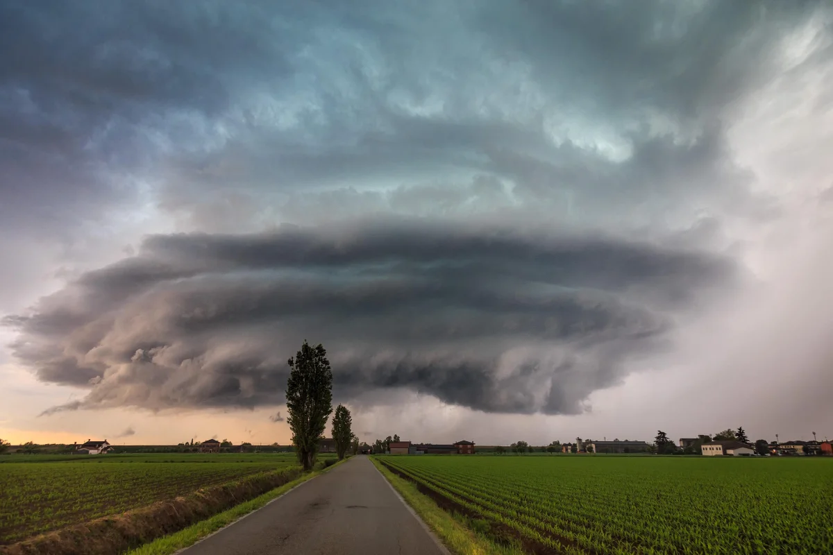
Roughly a thousand tornadoes a year — nearly all of them confined to a 500-kilometer-wide corridor across the Great Plains. No other region on the planet comes anywhere close to that number.
Tornadoes occur on every continent except Antarctica, but they're distributed across the planet extremely unevenly. The overwhelming majority of powerful funnels form in a single country, and largely within a single region of it.
Let's break down why America's central states became the world's tornado capital — and whether anything comparable exists anywhere else on Earth.
One Country, More Than Half the World's Tornadoes
The United States records an average of over 1,200 tornadoes a year — more than every other country on Earth combined. Canada comes in second with around 100 tornadoes a year, followed by Bangladesh, Argentina, the UK, Germany, and Australia.
Russia sees an estimated few dozen a year, though precise statistics are hard to pin down given how sparsely populated many of the territories these funnels pass through actually are.
Why the US specifically? The answer lies in a unique geography that no other country shares.
Tornado Alley: What This Place Actually Is
"Tornado Alley" is an unofficial term coined in 1952 by military meteorologists Robert Miller and Ernest Fawbush as part of a research project studying severe storms in Texas and Oklahoma. The "alley" has no fixed boundaries — it's more a statistical zone where tornadoes are recorded most frequently.
Its core runs through Texas, Oklahoma, Kansas, Nebraska, and South Dakota — a strip of the Great Plains stretching from the Gulf of Mexico to the Canadian border. An expanded version includes Iowa, Missouri, Illinois, and Minnesota.
According to the National Severe Storms Laboratory (NSSL), nearly a quarter of all significant tornadoes in the country occur within this corridor.
Why This Location, Specifically: Three Air Masses
The mechanism behind Tornado Alley is a collision of three air currents that doesn't reproduce anywhere else on the planet at this scale.
- Warm, moist air from the south. The Gulf of Mexico acts as a massive moisture generator. Warm surface air (77–86°F) flows freely northward through the coasts of Texas and Louisiana.
- Cold, dry air from the north. Arctic air masses from Canada slide freely south across the flat plains — there are no mountain barriers between the Arctic and the Great Plains.
- Dry, hot air from the west. The Rocky Mountains direct heated air from the Colorado Plateau and New Mexico's deserts eastward, adding another layer of atmospheric instability.
When these three air masses collide — which happens regularly in spring and early summer — enormously powerful storm systems form. The difference in temperature and humidity between the layers generates updrafts strong enough to spawn rotation inside the cloud — a mesocyclone — from which a tornado funnel descends.
Why the Mountains Hold the Key to the Puzzle
Europe also gets warm and cold air masses colliding, but tornadoes there occur dozens of times less often. The reason is terrain. The Alps, the Pyrenees, the Carpathians break up airflows, preventing them from colliding head-on across vast open stretches.
In the US, the Great Plains form a flat expanse 1,000 kilometers wide and 3,000 kilometers long, with not a single serious mountain barrier between the Gulf of Mexico and Canada. The air masses simply have nothing to snag on — they crash into each other at full speed.
In Russia, the West Siberian Plain could theoretically play a similar role — it's also flat — but there's no source of warm, moist air nearby comparable to the Gulf of Mexico. Without that "fuel" of moisture, powerful storm systems simply don't form.
Tornado Season: When the Alley Comes Alive
Tornadoes in the US are a seasonal phenomenon, tied to spring and early summer. Peak activity runs:
- April–May — the southern part of the alley (Texas, Oklahoma). Warm air off the Gulf is already strong, while Arctic cold hasn't yet retreated north.
- May–June — the central part (Kansas, Nebraska). The collision zone shifts northward, following the sun.
- July–August — activity fades: Arctic air retreats, and the contrast between air masses shrinks.
A second, less pronounced peak occurs in autumn — especially in the southeast, in "Dixie Alley" (from Mississippi to Georgia), where warm Atlantic air collides with the first cold intrusions of fall.
Dixie Alley: A Second Front
Over recent decades, scientists have increasingly noted a shift in peak tornado activity toward the southeast — into Mississippi, Alabama, Tennessee, and Georgia. This zone is called Dixie Alley, and it's arguably more dangerous than the classic corridor, for several reasons.
First, tornadoes here more often strike at night — warm Gulf air keeps arriving after sunset, and people asleep miss the warnings. Second, population density runs higher than on Kansas's empty plains. Third, the terrain is heavily forested — a funnel can't be spotted from a distance the way it can on open prairie.
Where Else on the Planet Sees Frequent Tornadoes
Beyond the US, a few other "hotspots" exist, though none approach American scale.
- Bangladesh is the only country where tornadoes regularly cause mass casualties. Population density is enormous, and warning systems were absent for a long time. The 1989 tornado near Daulatpur killed roughly 1,300 people — the deadliest in recorded history.
- Argentina and Uruguay — the Pampas work on the same principle as the Great Plains: flat terrain, warm moist air from the north, cold air from Patagonia. Tornadoes here can be powerful, but are recorded less often due to a sparser observation network.
- Central Europe — Germany, Poland, northern Italy. Tornadoes here are weak and rare, but do occur: 30 to 50 a year across all of Europe.
- Russia — a few dozen a year, mostly in the European part and southern West Siberia. Powerful tornadoes (F3 and above) occur roughly once a decade.
Can Tornadoes Be Predicted?
A specific funnel can't be predicted in advance — only the zone and time window when conditions ripen for one. The US Storm Prediction Center publishes a daily convective outlook, flagging elevated-risk zones for the coming 24 hours.
A specific tornado warning is issued once Doppler radar detects rotation inside a storm cell — leaving roughly 10–20 minutes before the funnel actually arrives.
For residents of Tornado Alley, those minutes are the difference between life and death. That's exactly why cities in Oklahoma, Kansas, and Texas enforce stricter building codes: homes come equipped with basement shelters, public buildings include storm rooms, and cities run siren systems that activate the moment a warning is issued.
Why Tornado Alley Is Here to Stay
As long as the Gulf of Mexico stays warm, Canada stays cold, and the Great Plains stay flat, the collision of these air masses will keep producing tornadoes. This isn't an anomaly or a temporary cycle — it's a permanent feature of the region's climate, no different from monsoons in India or hurricanes in the Caribbean.
Geography won't change, which means a thousand funnels a year isn't a record — it's the norm, and an entire culture has grown up around it: from storm shelters in every home to storm chasers who drive straight toward a funnel armed with a camera and an anemometer.