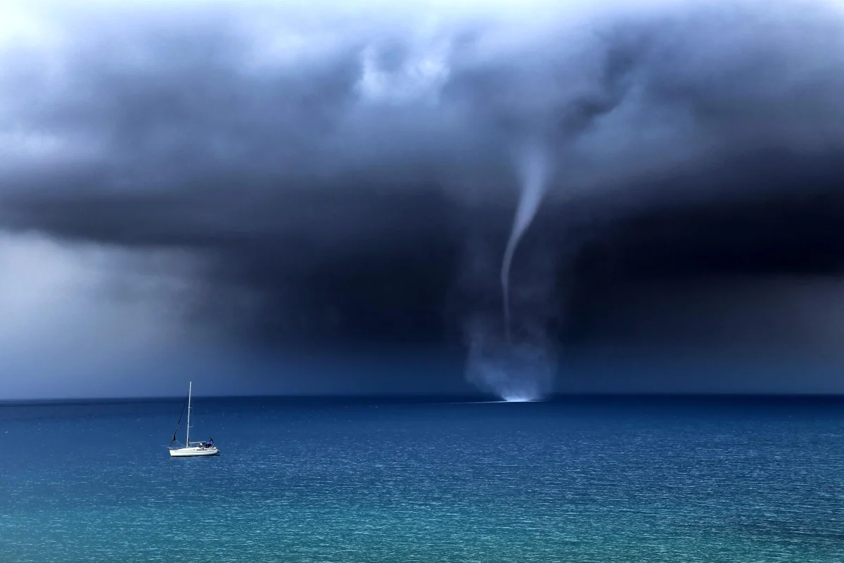
On June 26, 2026, several powerful tornadoes spun up simultaneously off the coast of Sirius, near Sochi — witnesses compared the sight to scenes from a Hollywood disaster film. A month later, a waterspout was recorded near Lermontovo in the Tuapse district. Over the past year, the Emergency Ministry for Krasnodar Territory issued tornado warnings six separate times in a single summer month.
Just a decade ago, tornadoes in Russia were seen as an oddity — the kind of thing that happens "once a generation." Today, residents of the Black Sea coast receive SMS warnings about possible tornadoes with the same regularity as storm warnings. Let's break down why the Caucasus coastline has become a risk zone, and what that means for an ordinary vacationer.
How a Tornado Forms: Step by Step
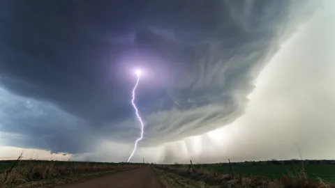
A tornado isn't a standalone phenomenon — it's a byproduct of a powerful thunderstorm. Turning an ordinary downpour into a rotating vortex requires a chain of conditions, each common on its own, but far rarer together.
Step one: an unstable atmosphere
Below: warm, moist air. Above: cold, dry air. The greater the temperature difference between layers, the stronger the updrafts — warm air surges upward, like a bubble in boiling water.
Step two: wind shear
Wind blows at different speeds and directions at different altitudes. This creates horizontal rotation — an invisible "roll" of spinning air. A powerful updraft tips that roll into a vertical position, producing a rotating zone inside the storm cloud — a mesocyclone.
Step three: funnel formation
A cone of rotating air begins descending from the lower part of the mesocyclone. Once it reaches the ground (or water), that's a tornado. Pressure inside the funnel drops sharply, and wind speed along its walls can reach 100 m/s or more — over 350 km/h.
The entire process, from the first updraft to touchdown, takes anywhere from 20 minutes to an hour.
Waterspouts: The Maritime Version
Along the Black Sea coast, what's most commonly observed isn't a classic land tornado but a waterspout — a funnel that forms over the sea. The mechanism is the same, but the "fuel" is the temperature difference between warm sea surface and cold air aloft.
Vasily Morozov, deputy head of Sochi's civil defense and emergency response headquarters, explains that phenomena like this occur more often in autumn, when the sea's warm surface contrasts sharply with cooling air over land. The collision of airflows at different temperatures creates vortices capable of rapidly developing into a waterspout.
A waterspout is typically weaker than a land tornado — wind speed rarely exceeds 80 km/h, and diameter runs from a few meters to a few dozen. But if the funnel makes landfall, it can turn into a full-fledged tornado, with genuinely serious consequences.
What's Been Happening on the Black Sea Coast
The chronicle of the past two years in the Kuban region leaves little doubt: tornadoes here are no longer rare.
August 2025 — a double waterspout over the Black Sea near Sochi. The funnels never made landfall, but were captured on video from just a few hundred meters offshore.
June 2025 — a tornado in the village of Defanovka, Tuapse district, damaging buildings.
May 2026 — a tornado along the Armavir–Otradnaya highway tore roofs off structures near the road.
June 26, 2026 — a series of powerful waterspouts near the Sirius coast. Witnesses posted footage showing water columns forming close to shore, with small boats losing control.
Meteorologist Alexey Kokorin identified one of the funnels as a mesocyclonic tornado spawned by a supercell, noting that the probability of landfall was very high.
July 22, 2026 — a waterspout near the village of Lermontovo, Tuapse district. It didn't make landfall, and there were no casualties.
Why Sochi and the Caucasus Coast Specifically
The Black Sea coast of the Caucasus brings together several conditions necessary for tornado formation, all at once.
- A warm sea. By midsummer, the Black Sea off Sochi warms to 77–81°F (25–27°C) — a powerful source of moisture and heat for the atmosphere.
- Nearby mountains. The Caucasus range, just a few dozen kilometers from shore, creates a sharp elevation gradient. Air masses climbing the slopes cool rapidly, generating powerful convection.
- Temperature contrast. In summer and early autumn, the sea's surface runs warmer than the air aloft — ideal conditions for updrafts. In autumn, that contrast intensifies further: the sea is still warm while the air has already started cooling.
- Wind shear. Sea breezes and mountain winds blow in opposite directions, creating exactly the kind of shear that twists air into a vertical spiral.
Are Tornadoes Actually Becoming More Frequent?
Science doesn't offer a clear-cut answer yet. The number of recorded tornadoes in Russia is rising, but that might not be entirely climate-driven: everyone on the coast now carries a camera in their phone, and social media spreads video within minutes. What once would have gone unnoticed over an empty stretch of sea now lands in dozens of lenses.
That said, meteorologists do note a trend: the number of dangerous convective events (severe thunderstorms, squalls, large hail) in Russia has increased over the past 30 years. The warm sea keeps getting warmer, contrasts grow sharper, and there's more energy available to fuel powerful storms.
Tornadoes are a byproduct of these storms, and if storms are becoming more frequent, it follows logically that tornadoes would too.
Can a Tornado Be Predicted?
Predicting the conditions for a tornado is possible: meteorologists can spot supercells and mesocyclones on radar 20–30 minutes before a funnel forms. This is exactly what the Emergency Ministry's SMS warnings are based on.
Predicting the exact location and timing of a specific funnel isn't possible. As Morozov points out, an element of randomness inevitably remains in the calculations: a rotation might spin up, or it might not; a funnel might make landfall, or it might dissipate over water.
For a vacationer, this means one thing: an SMS warning isn't "possibly, somewhere far away" — it's "conditions exist right now, and you should be ready."
What to Do If You See a Funnel
A waterspout on the horizon isn't cause for panic, but it is cause for action.
- On the beach
If you see a funnel over the sea, move inland away from the shore. Don't stay in open space — a waterspout can make landfall and cross the coastal strip within seconds. The best shelter is a sturdy building.
- On the water
Head to shore immediately. If shore is far away, move perpendicular to the funnel's direction of travel (it typically moves along with its parent storm cloud). Don't try to outrun it — move sideways instead.
- In a car
Don't stop under awnings or billboards — wind can bring them down onto the vehicle. If a tornado approaches, stop, duck below window level, and cover your head with your arms.
What This Means for the Resort Coast
Tornadoes on the Black Sea coast aren't new — isolated cases were recorded even in Soviet times. What's new is that they're now regular and visible — and that's shifting attitudes. For coastal residents, an Emergency Ministry SMS about possible tornadoes has become as routine as a storm warning.
For tourists used to associating tornadoes strictly with Oklahoma, this comes as a surprise worth preparing for.
There's no need for fear: the odds of a tornado directly striking any specific point on the shore remain tiny. But knowing what to do if you spot a funnel isn't overcaution anymore — it's simply part of being a well-prepared vacationer, on par with knowing the rules for swimming in a storm.