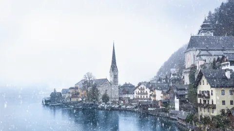
Same physical process, same water droplets, same visibility of a few dozen meters — only instead of floating two kilometers up, it's right in front of your windshield.
The air around us always contains water vapor — an invisible gas that evaporates from rivers, lakes, soil, and oceans. As long as the air is warm enough, it holds that vapor inside. But the moment it cools to a certain point, the vapor condenses into the tiniest of droplets. Billions of those droplets suspended in the air near the surface — that's fog.
The Dew Point: The Key to Everything
Air has a limit to how much moisture it can hold. That limit depends on temperature: warm air holds more vapor, cold air holds less. The temperature at which air becomes fully saturated and begins releasing moisture as droplets is called the dew point.
When air temperature drops to the dew point, fog appears. Not sooner, not later. That's exactly why fog most often forms at night and early morning: the ground cools, the adjacent layer of air cools with it, and at some moment it crosses the threshold.
You can test this at home: take a bottle of water out of the fridge and it instantly beads with droplets. The air around the cold glass cooled to its dew point, and moisture fell out onto the surface. In nature it's the exact same thing — only the "bottle" is the cooled ground, and the "droplets" are hanging in the air.
Why Different Fogs Behave Differently
Not all fogs form the same way. Meteorologists identify several types, each with its own scenario.
Radiation fog — the most common kind. It forms on clear, calm nights when the ground rapidly radiates heat into space. The lowest layer of air cools, moisture condenses. By morning, this fog can be extremely thick, but within a couple of hours after sunrise the sun warms the air and the fog dissolves.
The classic picture: a dense blanket in lowlands and river valleys, while hilltops sit under clear sky.
Advection fog — occurs when warm, moist air moves over a cold surface. The textbook example is a coastline: warm air from land drifts over cold water, cools, and releases its moisture. This type of fog can persist for days, because the source of cold — the sea — isn't going anywhere. St. Petersburg and London are famous for precisely this kind.
Evaporation fog — the reverse situation. Cold air passes over warm water. The water evaporates vigorously, the vapor enters the cold air and condenses immediately. It looks as if a river or lake is smoking. The effect is especially dramatic on an autumn morning, when the water still holds summer warmth but the air has already turned cold.
Frontal fog — forms at the boundary between warm and cold air fronts. Warm air rises over cold air, rain from the warm layer falls into the cold layer and partially evaporates, saturating it with moisture to the breaking point. This type of fog often accompanies prolonged rain.
Why Fog "Loves" Low Ground
Cold air is heavier than warm air and flows downhill — into river valleys, ravines, and basins. That's where it collects and cools fastest. So fog in lowlands is thick and lingers until midday, while at the same hour a hilltop nearby can be perfectly clear.
Bodies of water amplify the effect: a river or lake is a constant moisture source. The air above water is saturated with vapor, and the slightest cooling turns it into a foggy curtain. Hence the classic image — morning mist over a river, creeping along the banks.
Fog vs. Cloud: What's the Difference?
In physical terms, there is none. Both fog and clouds are water droplets suspended in air, each 1–10 microns in diameter. The only distinction is altitude. If condensation happens at ground level, it's fog. If it happens higher up, it's a cloud. A person who climbs a mountain and walks into a cloud sees ordinary fog all around.
Meteorologists draw a formal line: if visibility drops below 1,000 meters, it's fog. If it's between 1,000 and 10,000 meters, it's haze. The difference is terminological, but for aviation and maritime navigation it's critical.
Why Fog Is Dangerous
The primary threat is on roads. At visibility below 50 meters, a driver sees virtually nothing ahead. Headlights in fog don't help — they make things worse: light bounces off the droplets and creates a white wall in front of your eyes. That's why fog requires fog lights, mounted lower and angled at the road rather than straight ahead.
For aviation, fog is one of the leading causes of delays. Airports switch to low-visibility operations, landing intervals increase, and in dense fog flights are halted entirely.
Can Fog Be Predicted?
Yes — and with reasonable accuracy. Three parameters are needed: current air temperature, dew point, and wind forecast. If the gap between temperature and dew point is less than 2–3 degrees and the wind is light, fog is likely. The smaller the gap, the higher the chance.
If in the evening you notice the sky is clear, there's no wind, and grass is beading with dew — fog the next morning is almost certain. Dew and fog are close relatives: both appear when air reaches the dew point. The only difference is that dew settles on surfaces, while fog hangs in the air.