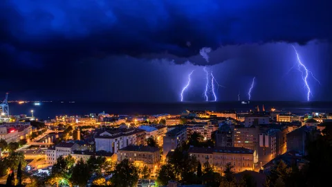
In the summer of 2026 alone, Moscow issued an orange weather warning at least four times — for abnormal heat in May and June, and for downpours with hail in July. Yet most residents still don't know how this level differs from yellow, or what they're specifically supposed to do when it's declared.
The color-coded warning system has been in use in Russia since 2010. The Hydrometeorological Center borrowed the concept from Europe's MeteoAlarm platform and adapted it: four colors, from green to red.
The idea is simple — a person sees the color and immediately grasps the threat level without parsing meteorological jargon. In practice, most people confuse the levels and don't understand when it's time to take action.
Four Colors, Four Threat Levels
Green — weather is normal, no threats. Temperature and precipitation are in line with the season. A summer day at +28°C or a winter frost at –15°C — that's green.
Yellow — potentially hazardous conditions. The weather is unpleasant but not threatening: strong wind up to 15–17 m/s, icy roads, a brief downpour. Worth paying attention, but no need to change your plans.
Orange — weather is dangerous. There's a probability of natural disasters and property damage. This is the second-highest level, and the one most frequently declared in major cities.
Squalls, hail-bearing downpours, abnormal heat, severe frost, blizzards — anything that can damage property, paralyze transportation, and threaten health.
Red — weather is very dangerous. Fatalities and major destruction are possible. Declared extremely rarely: Moscow hasn't seen a red level since 2010. Hurricanes, catastrophic flooding, temperatures below –50°C — events of a scale that triggers EMERCOM response and evacuation.
What Orange Specifically Means
Orange is the threshold where weather stops being merely inconvenient and becomes genuinely dangerous. The Hydrometeorological Center declares it for:
- Squall-force winds of 20–25 m/s — strong enough to snap branches, tear down advertising structures, and topple construction barriers.
- Rainfall exceeding 50 mm in a few hours — leading to street flooding, traffic shutdowns, and flooded underpasses.
- Hail 2 cm or larger in diameter — damages cars, smashes greenhouse glass, and can injure people.
- Abnormal heat — when temperatures exceed +30°C in Moscow or +35°C in southern regions and persist for several consecutive days.
- Severe frost — below –30 to –35°C for central Russia.
- Heavy snowfall and blizzards that paralyze traffic.
How to Behave During an Orange Warning
The general rules apply regardless of the specific hazard:
- Monitor updates. An orange level can be upgraded to red. Check the Hydrometeorological Center's website, EMERCOM phone notifications, and local news.
- Limit time outdoors. During squalls and hail, don't go out unless necessary. During heat waves, stay out of the sun from 11 a.m. to 4 p.m.
- Close windows and balconies. In wind and hail conditions, remove anything from balconies that could be blown off.
- Shelter your car. If hail is forecast, get the vehicle into a garage or under cover. Large hail can turn a car body into a pockmarked mess in under a minute.
- Stay away from trees, billboards, and scaffolding. At wind speeds above 20 m/s, any unsecured structure is a potential hazard.
- Keep a water supply and a charged phone. Heavy downpours can knock out electricity and water.
Special Guidance for Heat Waves
An orange warning due to abnormal heat is the most frequent summer alert in Moscow. In 2026 it was declared in May, June, and July. Heat is dangerous not through sudden impact but through cumulative effect: the body overheats gradually, and heatstroke strikes when a person is already unable to help themselves.
- Drink at least 2.5–3 liters of water daily, without waiting until you feel thirsty.
- Avoid alcohol and coffee — they accelerate dehydration.
- Don't do physical work outdoors during peak hours.
- Check on elderly relatives and neighbors — older people handle heat worse and don't always ask for help.
Why the System Draws Criticism
Russia's scale has a weak point — it doesn't account for regional differences. A –30°C frost in Yakutsk is an ordinary winter day. The same frost in Krasnodar is an emergency.
The orange level is formally identical for both cities, even though the appropriate response should be completely different.
The second problem is notification speed. According to expert assessments, in 40% of cases warnings arrive less than 12 hours before the hazardous event. For preparing for a storm, that's enough. For an evacuation, it's already too late.
The third is desensitization. When an orange level is declared several times a month, people stop taking it seriously. That's a mistake — the majority of weather-related property damage and injuries occur at precisely the orange level.
Where to Track the Warning Level
The current warning map is available on the Hydrometeorological Center's website, under the forecast warnings section. It includes region-specific forecasts showing the type of event, start time, and end time.
EMERCOM notifications are delivered automatically via the Cell Broadcast system — even if you've disabled app notifications, an emergency message will push through to your screen. But only at the red level. At orange, you'll need to rely on push notifications from weather apps and news aggregators.