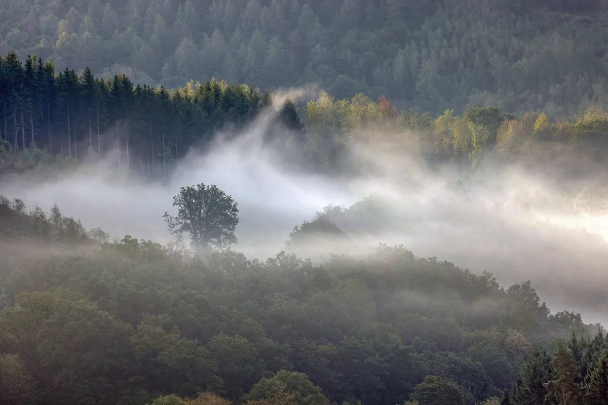
You step outside in the morning, and beyond the third lamppost, nothing's visible. Sounds go muffled, cars crawl at a walking pace, the world shrinks to a few meters. Fog can feel random, but it actually follows a clear seasonal pattern — one that's easier to explain than it might seem.
Fog frustrates drivers, delays flights, and ruins plans for a morning run. But behind that everyday inconvenience lies genuinely elegant physics: fog is essentially a cloud that's settled onto the ground. The only difference between the two is altitude — the underlying mechanism is identical. Let's break down why this mechanism fires up specifically in autumn and spring, rather than, say, January.
How Fog Actually Forms
Air always contains water vapor — invisible moisture evaporated from bodies of water, soil, and plants. How much vapor the air can hold depends on temperature: warm air holds more, cold air holds less.
When air cools to its so-called dew point, it can no longer hold all that moisture — the "excess" vapor condenses onto microscopic particles of dust, soot, and salt, forming tiny water droplets. Billions of these droplets, suspended near the ground, are what we call fog.
Meteorologists define fog as a condition where horizontal visibility drops below one kilometer.
Why Autumn Is the Prime Fog Season
Autumn creates nearly ideal conditions for fog — not through a single factor, but through several converging at once.
- Residual heat. Soil and bodies of water have stored up heat over summer and continue evaporating moisture. The air is saturated with water vapor — plenty of "raw material" for fog.
- Long nights. Starting in September, nights grow noticeably longer than days. Over a long night, the ground's surface has time to cool substantially, cooling the surface air layer down to its dew point. By dawn, moisture condenses, and fog spreads over fields, rivers, and city parks.
- Calm air. Autumn anticyclones — clear, quiet, windless — prevent the surface air from mixing with warmer layers above. The cold, humid layer stays put, and fog can linger for hours.
This type is called radiation fog — from "radiation" in the physical sense, not the nuclear one: the ground radiates (loses) heat into space, cools down, and the air above it condenses its moisture.
Spring Is the Mirror Image
Spring fog works on a similar principle, but in reverse. The air has already warmed up — daytime temperatures can reach 50–59°F (10–15°C). But the ground, and especially bodies of water, are still cold after winter. Warm, moist air flows over the cold surface, cools, and releases its moisture as fog.
This type is called advective fog (from the Latin advectio, "carried in"). It forms not through nighttime cooling, but through the horizontal movement of air masses — warm air arriving where the surface hasn't warmed up yet.
Advective fog is trickier than radiation fog: it doesn't necessarily dissipate with sunrise and can persist all day.
Why There's Less Fog in Winter
A reasonable question: winter is cold too — why less fog then? The answer lies in moisture content. At low temperatures, air physically can't hold much water vapor: at 5°F, its "capacity" runs roughly ten times lower than at 59°F. Less vapor means less condensation, means less fog.
The exception is freezing fog over unfrozen rivers and bodies of water: water at 34–39°F actively evaporates moisture, which condenses instantly in the freezing air. This "steaming" fog is often visible in winter over the Moskva River, the Neva, or open patches on frozen lakes.
Another winter type is a deep radiation fog: during a prolonged anticyclone, surface air cools day after day, and thick fog can blanket entire regions for weeks at a stretch.
Summer Fog Happens Too — Just Less Often and Briefer
Summer fog does occur, but it requires specific conditions: a very calm, clear night following rain, when humidity is high and wind is absent.
This fog typically settles into low-lying areas and river valleys and dissipates within an hour or two of sunrise — summer sun warms the surface quickly, and the dew point "retreats" downward.
Coastal areas tell a different story. Maritime advective fog can arrive even in summer: warm air off the land flows over cold water, and a band of fog sits along the shore. San Francisco is famous for exactly this kind of summer fog — the cold California Current generates it almost daily from June through August.
The City as a Fog Factory
Urban environments contribute their own share to the natural mechanism. A city's air contains dozens of times more condensation nuclei — particles moisture can cling to: exhaust soot, industrial dust, construction debris. The more nuclei present, the easier moisture condenses, and fog forms at a slightly higher temperature than it would in an open field.
This is exactly why cities get blanketed in fog more densely and more often than the surrounding countryside. London's smog of the 19th and 20th centuries was an extreme case: industrial emissions generated so many condensation nuclei that the city sat submerged in toxic fog for weeks at a time.
After the Clean Air Act passed in 1956, London's famous fogs largely disappeared — not because the climate changed, but because the air itself got cleaner.
Where in Russia Fog Is Most Common
The champions for number of foggy days are coastal areas and mountain valleys:
- The Kuril Islands and Kamchatka — up to 100–120 foggy days a year. The warm Pacific Kuroshio Current meets the cold Oyashio Current, and fog sits almost permanently over the zone where they collide.
- Sakhalin — especially its southern part, where sea fog regularly rolls onto shore from May through August.
- Kaliningrad — proximity to the Baltic and humid sea air produce frequent advective fog in spring and autumn.
- Central Russia — peak fog runs September–November, when radiation fog spreads across river floodplains on nearly every clear morning.
When Fog Turns Dangerous
Fog's greatest threat sits on the roads. Visibility drops to a few dozen meters, asphalt turns damp and slick, and drivers used to normal visibility don't slow down in time. The most accident-prone fog is autumn morning radiation fog: it's dense, sits low, and often arrives in patches — a driver exits a clear stretch and hits a white wall, going instantly blind.
In aviation, fog is the number-one cause of flight delays. Most airports have automated landing systems, but once visibility drops below 50–75 meters (Category IIIC), even those systems can't help, and the airport shuts down.
Why Fog Dissipates — and When It Doesn't
In about 70% of cases, radiation fog dissipates on its own, driven by morning sun. The ground warms, surface air heats up, its capacity for vapor increases, and the droplets evaporate back into the air. The remaining 30% of cases involve fog clearing due to rising wind or a shift in air mass.
Advective fog is more resistant to sunlight — it can persist all day as long as warm air keeps flowing over a cold surface. That's exactly why spring fog over rivers and lakes sometimes doesn't clear until evening — not until the wind shifts, or the surface finally warms up.